Tropical Storm Fernand spins in Atlantic while Caribbean system falls apart, NHC says
Published in News & Features
The National Hurricane Center on Monday continued to track Tropical Storm Fernand in the open Atlantic but dropped its forecast that a system entering the Caribbean would develop into the season’s next tropical depression or storm.
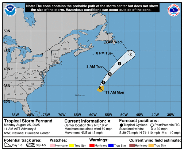
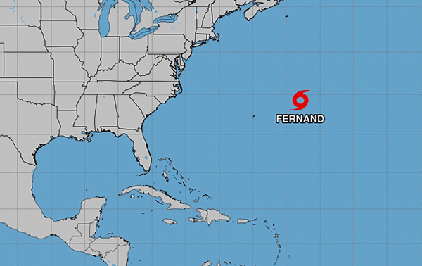
As of the NHC’s 11 a.m. advisory, the center of Fernand was located about 425 miles east-northeast of Bermuda moving north-northeast at 13 mph with maximum sustained winds of 60 mph. Tropical-storm-force winds extend out 80 miles.
“On the forecast track, Fernand should move across the open waters of the subtropical central Atlantic well east and northeast of Bermuda,” forecasters said. “Little change in strength is anticipated today, followed by gradual weakening on Tuesday, and Fernand is forecast to become a post-tropical cyclone on Wednesday.”
Fernand became the sixth named storm of the 2025 Atlantic hurricane season on Saturday, while the NHC is keeping track of what could be the seventh farther south in the Atlantic.
The NHC had been tracking a tropical wave that was passing over the Caribbean’s Windward Islands with showers and thunderstorms on Monday, but no longer forecasts it to continue development.
The National Oceanic and Atmospheric Administration recently updated its season forecast to call for 13-18 named storms this year, of which five to nine would grow into hurricanes. Two to five of those would develop into major hurricanes of Category 3 or higher.
The height of hurricane season runs from mid-August into October, while the entire six-month season runs June 1 to Nov. 30.
_____
©2025 Orlando Sentinel. Visit orlandosentinel.com. Distributed by Tribune Content Agency, LLC.


Comments